Combine All Information Together
Initial Data
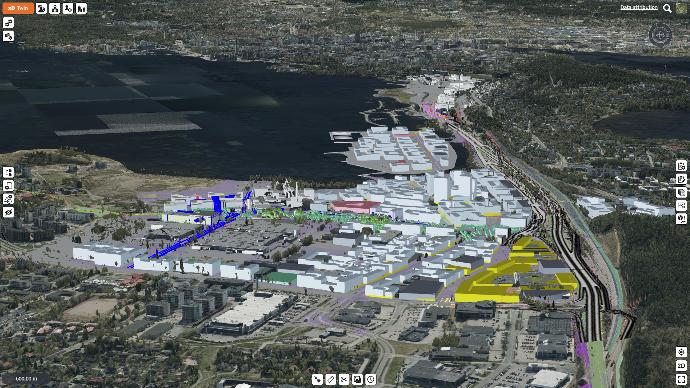
Manage projects in their real surroundings.
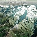
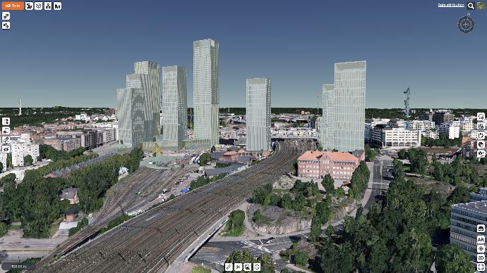
Virtual 3D Earth
Locate, visualize and analyze project context and relation to its surroundings anywhere in the world with global satellite images, maps, terrain and 3d-buildings.
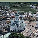
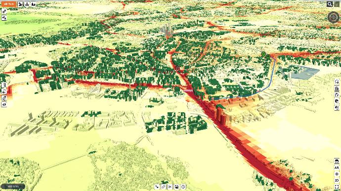
City Models
See how your project fits into the exiting cityscape and how it affects the surrounding city areas. Make sunlight shadow, visibility and view analysis for your designs with accurate data from surroundings.
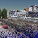
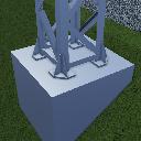
Survey Data
Create and maintain an accurate and up to date site situation model with survey data like point clouds and photogrammetry. Compare as-built measurements to desings for QA analysis and reporting.
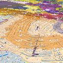
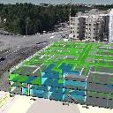
GIS
Bring more information into project model like base maps, nature, land use, traffic, networks, energy, emissions and services. Use open interfaces like WMS and WFS to always keep data up to date.
Project Data
Manage all disciplines and life cycle phases together.
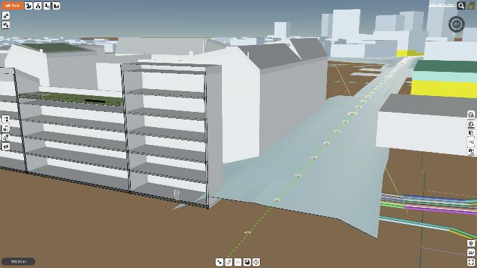
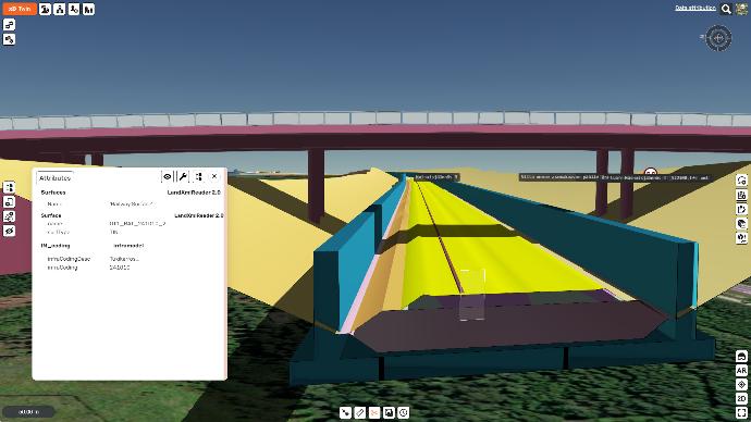
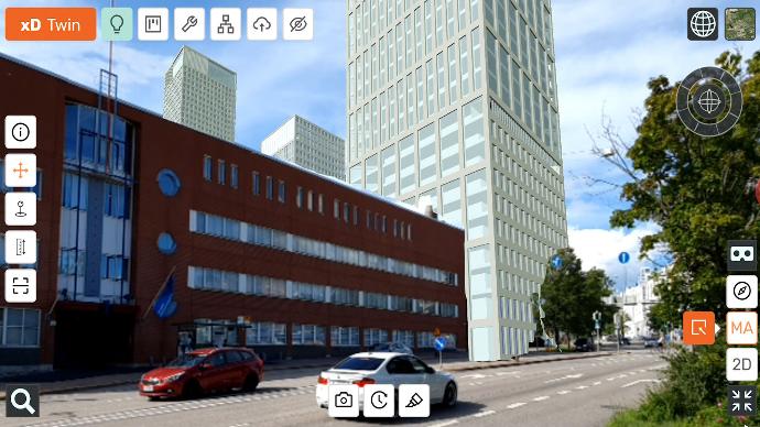
3D / CAD
Bring planning and visualization models into their real world locations and integrate with city models. Compare alternatives and make interactive presentations with realistic project surroundings.
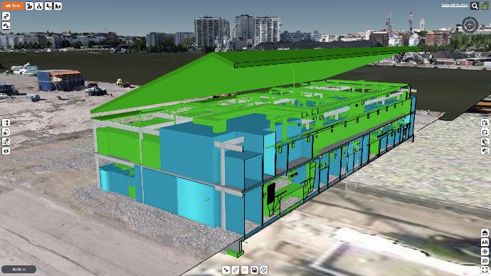
BIM for Buildings
Combine all building disciplines like architecture, structures and MEP / HVAC together. Manage buildings in real world locations and surroundings integrated with city models and GIS.
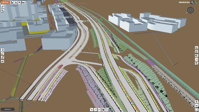
BIM for Infrastructure
Combine all infrastructure disciplines together like street, road, rail, bridge, tunnel and networks. Manage infrastructure in real world locations and surroundings integrated with city models and GIS.
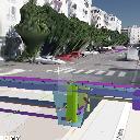
Documents with location
Bring documents into real world locations. Find and open documents faster next to related models and objects. Add also photos and view 360 photos directly from their locations.
Integrate Infromation into Processes
Collaboration
Combined all information into “one source of truth” project information model.
Share, brainstorm and collaborate with integrated collaboraiton tools.
Co-develop and optimize project solutions together with project teams and stakeholder groups.
Coordination
Coordinate all disciplines and all life cycle phases simultaneously.
Manage issues, tasks, approvals and QA workflows with integrated task management tools.
Simulate project implementation and maintain always up to date site situation model with 4D scheduling.
Communication
Communicate visually with interactive presentation models.
Enagage and participate citizens and stakeholders with on-line presentation models.
Collect strucutred feedback from your audience with customizable feedback forms.
Benefit from Advanced Workflows
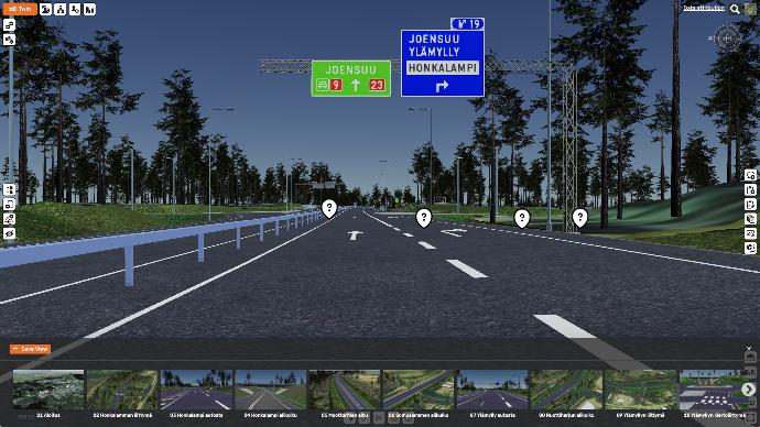
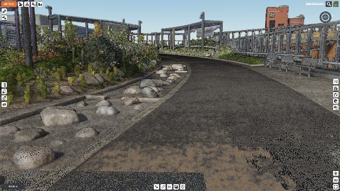
Real world surroundings
Analyze project effects and views in relation to its surroundings. Understand scales and distances better. Make presentations and communication more realistic.
Location based task management
Link tasks to location, views and models. Assign tasks to persons. This way data always follows tasks rotate from person to another.
Task phases
Pre-configure phases and responsible persons for tasks to manage task rotations. Use is for example to QA and approval workflows.
Dashboard
See and communicate project status in one page with visual graphs. Follow task and project statistics and identify potential bottlenecks.
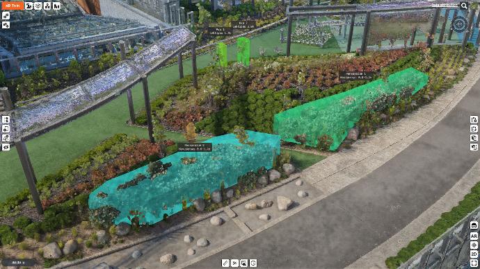
Sketch modeling
Sketch and analyze new ideas and alternatoves with easy rapid modeling tools. Create single elements, corridors, areas and volumes, even with 3d model libraries.
Interactive presentations
Present projects interactively with saved viewpoints. Use models like slideshows, with very easy, visual and interactive presentation tools.
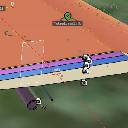
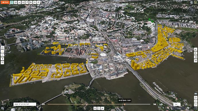
4D Scheduling
Simulate project, city area or even the whole city development open time in 4D. Manage new construction, temporary elements and demolition operations.
Location based document management
Documents are much faster and easier to find when they are found close to related data. With GPS it is easy to find documents around you when on-site.
Checklists
Add checklists to tasks to ensure that task is completed with wanted content and quality. Follow ask completion with reports what was done when and by who.
Custom attributes
Add information like cost, CO2 and other attributes. Manage for example costs and CO2 in area development project or even in whole city level.
Reports and calculations
Calculate reports from information, for example total number of objects, total areas and volumes or bill of materials. Get also automatic reports for tasks and feedback.
Citizen participation
Engage and participate citizens and stakeholders to co-develop projects with public on-line models with feedback forms. Collect and analyze structured feedback.
Any Type of Projects
City Planning
Manage and collaborate city plans with citizens with a 4D digital twin of a city and feedback tools
Architecture
Manage architecture in their real world location and integrate into city models. Compare architecture competition alternatives with VR and AR.
Infrastructure
Manage even large scale infrastructure projects and combine designs with survey, drone and as-built data.
Transportation
Manage harbor, airport and logistics center projects by combining infrastructure, buildings, and city models.
Environment
Bring landscaping and environmental planning live with AR and VR. Manage environmental effects analysis in large scales.
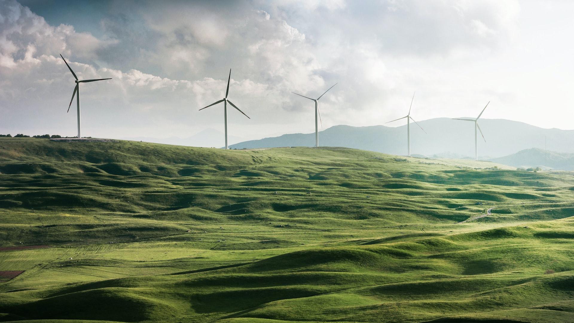
Energy
Manage geographically large distribution networks, windmill parks and power plants in their real world surroundings.
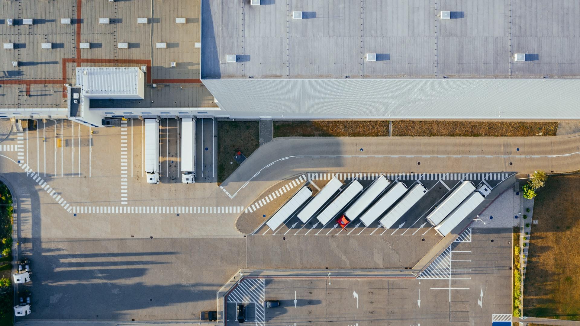
Industry
Combine buildings, machines, processing plants and infrastructure into one digital twin of the facility.
Real estate
Show apartments and housing virtually in their real location and surroundings with city model integration.
No Limits
Any project types
xD Twin manages built environment as one digital twin, all domains together, like in real world. xDTwin will manage your project weather it is a city plan, building, infrastrucure, transportation, industrial, energy or any combination of these.
All disciplines
xD Twin manages all built environment disciplines together like city plans, architecture, structures, MEP / HVAC, steets, road, rail, bridges, tunnels, structures, networks, utilities, landscaping, equipment, traffic guidance, lighting, +++
Unlimited amount users
One of the biggest obstacles taking new tools into use is the licensing policy and purchasing bureaucracy. xD Twin removes these obstacles by offering unlimited amount of users so everyone can join, use and benefit from the tools.
Any project scales
Projects are in many scales. xD Twin manages project data in all scales; global, national, regional, city, city area and up to single city blocks or buildings, and still handles all details from global scale up to single bolts and screws.
All life cycle phases
When cities and areas develop they are built in phases. xD Twin manages all life cycle phases, same time, in same model, with time perspective (4D). You can manage planning, design, construction, operations and maintenance together.
Unlimited size datasets
Data amount is not a problem any more. xD Twin can handle unlimited size datasets with its of smart intelligent database sreaming technology. Massive datasets like billions of lidar points, city wide photogrammetry or 100's of BIM models load in seconds and runs smoothly even on mobile devices.
Anytime, Anywhere, Easy and Fast

Anytime, anywhere
xD Twin is a cloud based solution that works completley inside any browsers. It can be used by anyone, anywhere, at anytime. Users will always have same tools, latest version, and there is no need to install any apps.
Easy
Anyone can learn and use xD Twin instantly. User interaface has been designed to be intuitive and easy to use. Navigation follows generic map app navigation styles which most users are already used to. All tools are available in icon based user interface which is like an universal language.
Fast
No more waiting or sluggish updates. With xD Twin you will get access to data almost instantly, in seconds. xD Twin can manage unlimited size datasets very fast. Even largest projects with gigabytes of BIM, GIS, city models, point clouds and other data opens in seconds, even on mobile devices. Viewing models in real-time is also very fast and makes viewing project data very fluent and enjoyable.
Any device
xD Twin works with any smart device independent from brands or operating systems. It works from desktop computers to laptops, tablets and mobile phones.
With your own language
xD Twin is available in your native local languages, for example in English, Spanish, Swedish and Finnish. We will add new languages while we expand in global markets.
Award Winning Solution
UrbanSense
Innovation competition winner in 2019:
"Augmented reality for city planning using 5G networks"
UIA Hope
Innovation competition winner in 2020:
"Air quality digital twin for city planning"
B.Green
Innovation competition winner in 2021:
"Green infrastructure mapping for city digital twins"
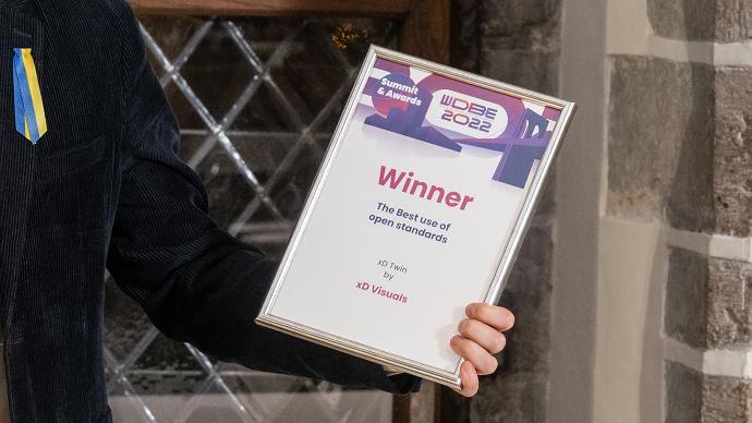
WDBE 2022
International awards winner in 2022:
"The best use of open standards"
Trusted by Leading Organizations


Happy Users
Flexible and Scalable Licensing
Unlimited users
We allow everyone to benefit
You can invite as many users you want to your projects with different roles without extra cost, across organization boundaries and without licensing bureaucracy.
Start light and grow
We flex with your growth
You can start light with single project and upgrade to multiple projects up to unlimited projects based on your needs and your organization growth.
Pay only for storage
We scale with your needs
Pricing is based on storage . This will scale up with both amount of projects and project size. You pay little in the begining and little more when your usage grows.